


Precinct 2, Golden Valley County, Montana
About
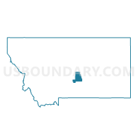
Outline

Summary
| Unique Area Identifier | 612055 |
| Name | Precinct 2 |
| County | Golden Valley County |
| State | Montana |
| Area (square miles) | 588.98 |
| Land Area (square miles) | 588.09 |
| Water Area (square miles) | 0.89 |
| % of Land Area | 99.85 |
| % of Water Area | 0.15 |
| Latitude of the Internal Point | 46.41042900 |
| Longtitude of the Internal Point | -109.03708350 |
Maps


Graphs
Select a template below for downloading or customizing gragh for Precinct 2, Golden Valley County, Montana


Neighbors
Neighoring Voting District (by Name) Neighboring Voting District on the Map
- Precinct 1, Golden Valley County, MT
- Precinct 46D, Yellowstone County, MT
- Precinct 5, Musselshell County, MT
- Precinct 9, Stillwater County, MT
Top 10 Neighboring County Subdivision (by Population) Neighboring County Subdivision on the Map
- Lewistown CCD, Fergus County, MT (9,097)
- Northwest Yellowstone CCD, Yellowstone County, MT (7,558)
- Roundup CCD, Musselshell County, MT (2,552)
- Klein CCD, Musselshell County, MT (1,574)
- North Stillwater CCD, Stillwater County, MT (767)
- Grass Range CCD, Fergus County, MT (560)
- Ryegate CCD, Golden Valley County, MT (506)
- Lavina CCD, Golden Valley County, MT (378)
Top 10 Neighboring Place (by Population) Neighboring Place on the Map
Top 10 Neighboring Elementary School District (by Population) Neighboring Elementary School District on the Map
- Roundup Elementary School District, MT (4,109)
- Broadview Elementary School District, MT (838)
- Grass Range Elementary School District, MT (510)
- Rapelje Elementary School District, MT (240)
Top 10 Neighboring Secondary School District (by Population) Neighboring Secondary School District on the Map
- Roundup High School District, MT (4,246)
- Broadview High School District, MT (927)
- Grass Range High School District, MT (594)
- Rapelje High School District, MT (343)
Top 10 Neighboring Unified School District (by Population) Neighboring Unified School District on the Map
Top 10 Neighboring State Legislative District Lower Chamber (by Population) Neighboring State Legislative District Lower Chamber on the Map
- State House District 46, MT (13,942)
- State House District 60, MT (10,003)
- State House District 83, MT (9,653)
- State House District 45, MT (9,438)
- State House District 30, MT (9,083)
Top 10 Neighboring State Legislative District Upper Chamber (by Population) Neighboring State Legislative District Upper Chamber on the Map
- State Senate District 23, MT (23,380)
- State Senate District 42, MT (20,506)
- State Senate District 30, MT (19,092)
- State Senate District 15, MT (17,708)
Top 10 Neighboring 111th Congressional District (by Population) Neighboring 111th Congressional District on the Map
Top 10 Neighboring Census Tract (by Population) Neighboring Census Tract on the Map
- Census Tract 14.02, Yellowstone County, MT (5,634)
- Census Tract 301, Fergus County, MT (5,011)
- Census Tract 9666, Stillwater County, MT (3,098)
- Census Tract 1, Musselshell County, MT (2,539)
- Census Tract 1, Golden Valley County, MT (884)
Top 10 Neighboring 5-Digit ZIP Code Tabulation Area (by Population) Neighboring 5-Digit ZIP Code Tabulation Area on the Map
- 59457, MT (9,105)
- 59072, MT (4,140)
- 59015, MT (576)
- 59074, MT (490)
- 59046, MT (390)
- 59067, MT (221)
- 59441, MT (82)